CAVES & TOURISTIC SITES FOR VISITING DURING THE CAMP
Vratsa region – background
Within this region, most of the mountain Vrachnska Planina is situated – a band ortiented NE-SW. It rises sharply above the plain of Vratsa and the hilly area of Mezdra – bordering it on the northeast. The slopes are abrupt, rocky, about 600 - 700 m high. The valley of Leva River subdivides it into two parts: Bazovska (southeastern) and Stresherska (northwestern), with the highest summits respectively Buk (1394 m) and Streshero (1212 m). The valley of Leva River has formed the picturesque gorge Vratsata between Zgorigrad and Vratsa. In general, plateau-like relief is typical for the subregion, with peneplenized surface, mainly between 1000 and 1200 m a.s.l. and abrupt slopes towards the bordering rivers, Vratsa Plain and Mezdra Lowland. The peneplenized area features a typical karst relief with residual tumuli, separated by poljes, blind dolines and blind valleys. Other surface forms are developed as well - funnels, karren, karren fields.
For the forming of karstic features here, especially important is the thick Upper Jurassic and Lower Cretaceous limestone. Underneath, there are rocks of Middle and Lower Jurassic (aleurolyths and aleuryths), missing in some places. A Trias carbonate complex (karstified limestone and dolomite) follows. In their base, they transit into Lower Trias sandstone and aleurolyths. The geological cross-section is best seen on the surface of the southwestern slopes and near Zgorigrad Village.
The basic tectonic structure here is the Zgorigrad Anticline, almost overlapping the Vratsa Subregion. From this anticlyne the arch and the northern limb are preserved, which determines the situation of the limestone layers. In their peneplenized parts, they are almost horizontal, on the northeastern slopes they are steep and in some places vertical. The pressure south – southwest determines the directions of the basic fissure systems. Contemporary karstification is due mostly to rainfall water, the average rainfall amount being about 800 - 1000 mm. In the peneplenized parts there is almost no constant surface outflow, as the entire amount of rainfall is taken by the surface karst forms. After its penetration into the massif, the water goes towards its periphery, surfacing as karstic springs. The most important ones are situated at the base of the northeastern slope - the source near Toshova Dupka, Stoyanovo Village (outflow 78 - 390 l/sec), near Matnishki monastery (total outflow 138 - 430 l/sec), near St. Ivan Pusti monastery (ca. 10-15 l/sec), near Bistrets Village (127 - 780 l/sec), near Pavolche Village (3 - 497 l/sec), as well as the two sources in Iskâr Valley near Cherepish Railway Station (respectively 33 - 1010 l/sec and 11 - 139 l/sec). On the southern side, the two sources above Zverino Village and the source Chigoril (up to 40 l/sec) are situated. In the central parts of the massif, in the valley of Leva River, there are the sources above Zgorigrad Village (total of 20 - 250 l/sec) and the source Ludoto Ezero (8 - 220 l/sec). According to the geological conditions the sources are mostly contact ones, surfacing on the contact between the karstified and the non-karstified rocks. Only the situation of the sources near Cherepish Railway Station and Ludoto Ezero is determined by the base of erosion.
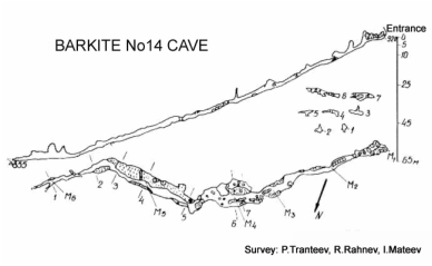
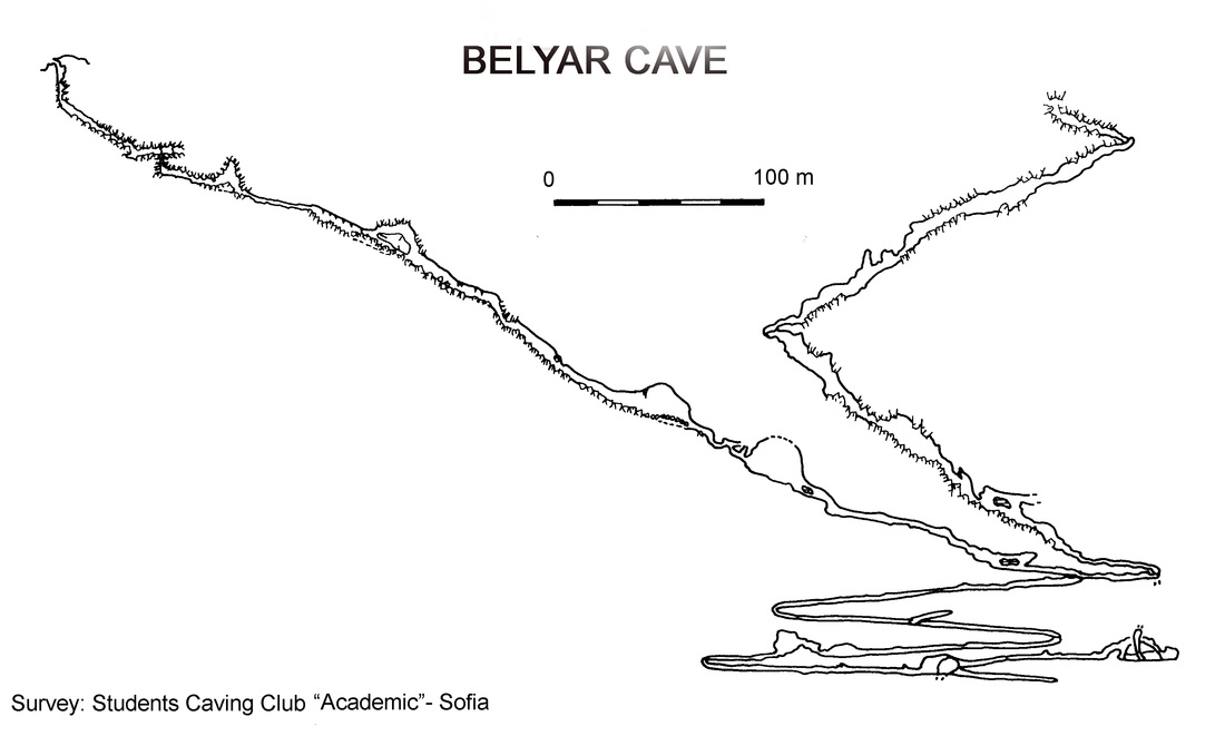
As a whole, in the region more than 300 caves were known. More numerous, although smaller are the caves in the eastern part. However, in the western part most of the bigger vertical caves are situated. So far, in Vratsa Mountain there are seven cave potholes and proper potholes over 100 m deep (some of them also of considerable length).
Besides the caves, the water caves, situated immediately close to the big karstic springs, are also interesting. Here the show cave Ledenika is situated.